高德地图引入遮罩后获取地区数据的时候遮罩又消失了,为什么尼?
引入遮罩的目的是为了地图只显示中国区域,但遮罩是可以正常覆盖掉中国地图外其他区域的,但获取到了接口数据,将全国各地的数据渲染到地图上面后,遮罩就整体消失了,为什么尼?
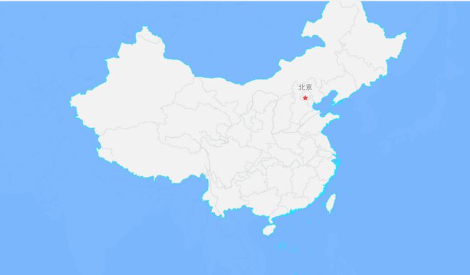
图一:遮罩效果:
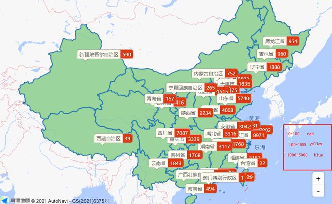
图二:获取到数据后遮罩消失了:
期望的效果是:
遮罩成功遮住中国地图以外的地图,但中国地图各区域的数据也能正常显示。
代码:
// 初始化地图相关实例 initMap() {
const that = this;
lazyAMapApiLoaderInstance.load().then(() => {
new AMap.DistrictSearch({
extensions: "all",
subdistrict: 0
}).search("中国", function(status, result) {
// 外多边形坐标数组和内多边形坐标数组
var outer = [
new AMap.LngLat(-360, 90, true),
new AMap.LngLat(-360, -90, true),
new AMap.LngLat(360, -90, true),
new AMap.LngLat(360, 90, true)
];
var holes = result.districtList[0].boundaries;
var pathArray = [outer];
pathArray.push.apply(pathArray, holes);
var polygon = new AMap.Polygon({
pathL: pathArray,
strokeColor: "#00eeff",
strokeWeight: 1,
fillColor: "#71B3ff",
fillOpacity: 0.9
});
polygon.setPath(pathArray);
console.log(polygon, "polygon");
that.map.add(polygon);
that.setMapData("", "", ""); // 此方法为获取后端数据渲染各地区的数量
});
that.map = new AMap.Map("container", {
zoom: 4.5,
center: [113.612427, 36.303573],
mapStyle: "amap://styles/whitesmoke"
});
// that.setMapData('','','');
});
},
回答:
已解决,先将遮罩封装成一种方法,在加载数据的时候调用遮罩方法
以上是 高德地图引入遮罩后获取地区数据的时候遮罩又消失了,为什么尼? 的全部内容, 来源链接: utcz.com/p/936738.html


